Kangchenjunga (8,586 m) — the world's third highest mountain, straddling the Nepal-Sikkim border in Nepal's remote far east — from its North Base Camp at Pangpema (5,143 m) by private helicopter from Bhadrapur or Kathmandu. Nepal's least-visited 8,000-metre peak and one of the most sacred mountains in the Himalayan Buddhist tradition, rising above the Tamur valley in a five-summited massif that George Mallory called the most beautiful mountain in the world.
Kangchenjunga (8,586 m) — the world's third highest mountain, after Everest (8,849 m) and K2 (8,611 m) — stands in Nepal's remote far eastern corner, rising above the Tamur River valley of Taplejung District on Nepal's side of the border with the Indian state of Sikkim. The mountain is a five-summited massif — the name Kangchenjunga derives from the Tibetan for "Five Treasuries of Snow," referring to the five summits and the five repositories of salt, gold, silver, gems, and grain that Tibetan Buddhist tradition believes the mountain guards. For the people of Sikkim, Kangchenjunga is a Yul-lha — a mountain deity and the protective spirit of the land — and holds the same sacred status in the Buddhist geography of the region as Everest holds in the Sherpa Buddhist world of the Khumbu.
Nepal's Kangchenjunga region is the country's most remote major trekking destination — the standard approach to the North Base Camp (Pangpema, 5,143 m) requires a 21-day round trip from Taplejung, through the extraordinary Kangchenjunga Conservation Area. The helicopter tour compresses this approach to a single day (with one overnight at or near the base camp), delivering the full scale of the mountain and its setting in a timeframe that the overland approach cannot achieve for visitors with limited itineraries.
Pangpema (5,143 m), the North Base Camp for all climbing expeditions approaching Kangchenjunga's north side, is one of the highest and most remote expedition base camps in Nepal — and the helicopter landing zone for this tour. The name means "prayer flat" in Tibetan, and the site's character — a wide, flat glacial outwash area at the terminus of the Kangchenjunga Glacier, with the mountain's northern face directly above — justifies the name. At 5,143 m, Pangpema is the highest base camp helicopter landing in Nepal outside the Khumbu (higher than Dhaulagiri BC at 4,750 m, Manaslu BC at 4,480 m, or ABC at 4,130 m), and the altitude is immediately physical: at this elevation, approximately 54% of sea-level oxygen is available, and the cold, even in the warmest months, is genuine.
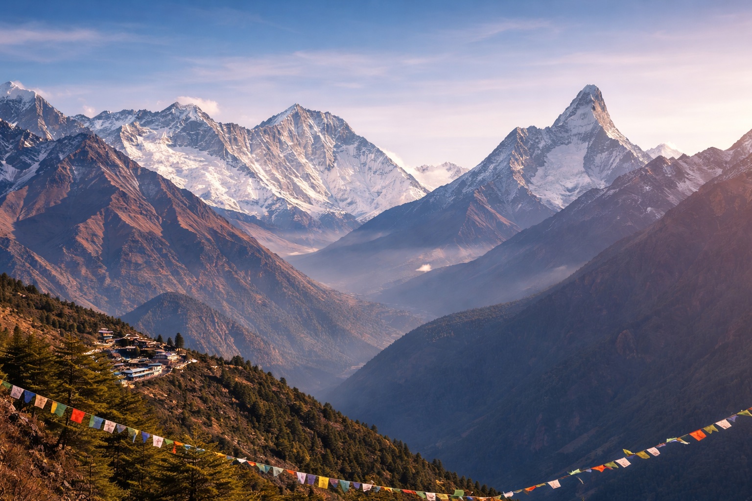
The Kangchenjunga north face, visible from Pangpema in its complete vertical extent from the glacier floor to the summit pyramid, is one of the most impressive mountain faces in the world: a 3,400-metre wall of rock and ice, the upper sections perpetually coated in a thick layer of glacial ice that reflects the morning sun in blue-white plates. The Yalung Glacier and the Zemu Glacier (on the Sikkim side) are not visible from this position, but the main Kangchenjunga Glacier flows directly south from the north col toward the base camp, its surface a maze of ice towers, crevasses, and moraine that represents, in its visual complexity, the accumulated geological history of the mountain's ice age.
The Kangchenjunga Conservation Area (KCA) is the easternmost of Nepal's protected high-altitude zones — a 2,035 km² wilderness in Taplejung District that protects one of the most biodiverse landscapes in Nepal. The KCA is home to the largest confirmed snow leopard population in Nepal's far-eastern Himalaya, a significant red panda population in the bamboo and rhododendron forests of the middle elevation (2,500–3,500 m), Himalayan black bear, musk deer, and clouded leopard in the lower forest zones. The helicopter approach from Taplejung airport crosses the KCA's altitudinal gradient — from subtropical lower valleys through temperate oak and rhododendron forest to the high-alpine and glacial zones — providing an aerial summary of one of Nepal's most ecologically complete protected areas.
For the Tibetan Buddhist communities of Taplejung and the Sikkimese Lepcha and Bhutia peoples across the border, Kangchenjunga is not merely a mountain but the physical manifestation of a deity — the protector of Sikkim and guardian of the five treasuries. The Dzongri and Goecha La trekking routes on the Sikkim side are as much pilgrimage circuits as recreational trails, and the Kangchenjunga Conservation Area on the Nepal side preserves the sacred groves, springs, and sites that form the mountain's ritual landscape. Our guide on the helicopter tour provides context for this sacred geography during the ground stop at Pangpema, explaining the mountain's significance in the Buddhist tradition of both Nepal and Sikkim.
Yes — Kangchenjunga is the most remote of Nepal's major mountain helicopter destinations. The approach from Kathmandu requires either a domestic flight to Bhadrapur (east Nepal) followed by a helicopter, or a direct 2.5–3 hour helicopter flight. The mountain itself lies in Nepal's least-visited district (Taplejung), has fewer than 500 trekking visitors per year to its base camp area (compared to thousands for Everest or Annapurna), and the Kangchenjunga Conservation Area has no roads — the helicopter is the only mechanised access. This remoteness is the primary appeal for many clients: the experience of being at one of the world's great mountains in a setting that feels genuinely unexplored.
Yes — the Kangchenjunga Conservation Area (KCA) restricted area permit is required for all visitors to the Kangchenjunga trekking area, including those arriving by helicopter. The permit costs USD 10 per day (minimum 10 days, USD 100) and must be arranged through a registered Nepali trekking agency — individual tourists cannot obtain the permit directly. The permit is included in our tour price and is arranged before departure. Additionally, trekkers visiting Kangchenjunga must be in a group of at least two (a solo trekker rule that also applies to helicopter tour clients — we can arrange a group match for solo travellers).
The KCA is one of Nepal's most ecologically significant protected areas. It protects a continuous altitudinal gradient from subtropical forest (below 1,500 m) through temperate oak, rhododendron, and bamboo (1,500–3,500 m) to sub-alpine and alpine zones (above 3,500 m) — a gradient that supports exceptional biodiversity. The KCA is estimated to have the highest density of snow leopards in far-eastern Nepal, a significant red panda population, over 300 bird species (including the endangered rufous-necked hornbill, chestnut-breasted partridge, and many Himalayan endemics), and several medicinal plant species of conservation significance. For wildlife observers and naturalists, the aerial survey of the KCA's altitudinal zones during the helicopter approach is itself a significant part of the tour's appeal.
No — Kangchenjunga straddles the border between Nepal (Taplejung District) and the Indian state of Sikkim. The main summit (8,586 m) and three of the five major summits are on the Nepal-Sikkim border line. The south and southwest faces, and the Yalung and Zemu glaciers, are in Sikkim. The north and northwest faces, including the Pangpema base camp approach, are in Nepal. Nepal climbing expeditions approach via the north; Sikkim-side expeditions approach via the south and southeast (the route used for the first ascent by Charles Evans's British expedition in 1955). By convention and historical agreement, climbers approaching from Nepal stop just below the true summit to show respect for Sikkim's belief that the summit itself should remain inviolate as a divine site.